Mapping by Drone
Centimetric RTK precision — professional turnkey GIS deliverables
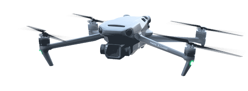
Aerial work
Your territory, seen from above
Drone mapping is a certified aerial operation: each mission is planned by qualified remote pilots, executed according to an automated flight plan and delivered with ready-to-use georeferenced data. Ground resolution up to 1 cm/pixel thanks to centimetric RTK positioning.
Our drones cover surfaces of 10 to 3,000 hectares per mission. Raw data is processed by SfM photogrammetry to produce orthophotos, DTM/DSM, point clouds and contour lines — directly integrable into your GIS tools.
Contact us1 cm/px
Ground resolution
RTK
Centimetric precision
3 000 ha
Maximum coverage
24-48 h
Delivery time
Our deliverables
Turnkey mapping products
Georeferenced orthophotos
Geometrically corrected aerial images, georeferenced in WGS84 or local systems (UTM Zone 32N for Niger).
Formats: GeoTIFF, ECW, JPEG2000Digital models (DTM/DSM)
High-resolution Digital Terrain Models (DTM) and Surface Models (DSM) for topographic and volumetric analyses.
Formats: GeoTIFF, XYZ, LASContour lines
Equidistant contour lines (1 m, 0.5 m or 0.25 m depending on resolution) in vector GIS format for direct integration.
Formats: SHP, DXF, KMLTextured 3D models
Photorealistic 3D reconstruction of buildings, infrastructure and terrain for visualization and communication.
Formats: OBJ, FBX, 3D TilesPoint clouds
Dense point clouds (millions of points) for precise analysis, BIM and advanced modeling.
Formats: LAS, LAZ, E57Volumetric calculations
Accurate earthwork volumes for grading, storage, quarries — cut/fill volume reports.
Format: PDF + Excel spreadsheetWhich tool to choose?
Drone vs ULM
Drone
Small to medium surfaces- Surfaces 10 – 3,000 hectares
- Resolution 1 to 5 cm/pixel
- Precision centimetric RTK
- Vertical takeoff, no runway
- Hovering for complex areas
- RGB, thermal, multispectral sensors
- Delivery 24-48 hours
ULM
Very large surfaces- Surfaces > 3,000 hectares
- Speed 150–175 km/h
- Large format metric cameras
- Autonomy 4 to 8 hours
- Altitude up to 3,000 m
- Exclusive Intellipod technology
- National coverage in a few missions
Use cases
Fields of application
Precision agriculture
NDVI mapping, crop monitoring, irrigation management, cultivated area calculations.
Construction & infrastructure
Site monitoring, earthwork volumes, topographic surveys, structure inspection.
Mining & quarries
Monthly volumetric calculations, exploitation monitoring, resource management plans.
Urban planning & cadastre
Urban mapping, cadastral update, land use planning.
Environment & forests
Forest inventories, deforestation monitoring, wetland mapping.
Real estate & development
Aerial views of properties, subdivision plans, 3D mock-ups of real estate projects.
Risk management
Post-disaster mapping, flood zones, damage assessment.
Our process
From mission to deliverable in 5 steps
1
Requirements
Precise needs definition2
Planning
Automated flight plan3
Acquisition
Automated RTK flight4
Processing
SfM photogrammetry5
Delivery
Finalized GIS deliverablesAverage time: 24 to 48 hours after acquisition depending on mapped area
Launch a projectTake action
Need drone mapping?
Tell us your project: area, location, deliverable needs. Our team responds within 24 hours.
Contact us ULM mapping